Renewable Resource Maps
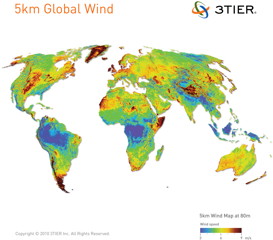 Renewable resources information company 3TIER has produced a number of resource maps showing such things as wind speed, solar irradiance and precipitation to suggest renewable-energy potential; at right, for example, is a map showing global mean wind speed at an altitude of 80 metres at five-kilometre resolution. Via Ogle Earth.

Comments
blog comments powered by Disqus