New Map of Global Forest Heights
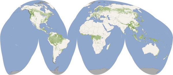
Scientists have released a global map of forest canopy heights based on NASA data. “Although there are other local- and regional-scale forest canopy maps, the new map is the first that spans the entire globe based on one uniform method,” says the NASA press release. “The work — based on data collected by NASA’s ICESat, Terra, and Aqua satellites — should help scientists build an inventory of how much carbon the world’s forests store and how fast that carbon cycles through ecosystems and back into the atmosphere.” Via Boing Boing.

Comments
blog comments powered by Disqus