More on the Gulf of Mexico Oil Spill
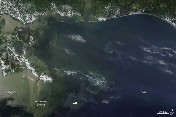
An image of the Deepwater Horizon oil spill in the Gulf of Mexico taken on Monday by the MODIS instrument on NASA’s Terra satellite:
Via multiple sources, this animation is a computer model of how the oil spill might spread based on ocean currents:
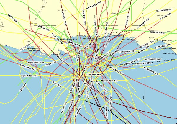
It’s now hurricane season in the Gulf of Mexico and the Caribbean; Talking Points Memo reproduces this map showing the paths of hurricanes passing near the Deepwater Horizon platform (shown as a star in the centre of the map) over the past hundred years. (It’s a NOAA map, apparently, but I can’t find the original source.)
Previously: Time-Lapse Video of the Gulf of Mexico Oil Spill; The New York Times’s Interactive Oil Spill Map; Mapping the Gulf of Mexico Oil Spill; Gulf of Mexico Oil Spill Update.

Comments
blog comments powered by Disqus