Manitoba Historical Maps
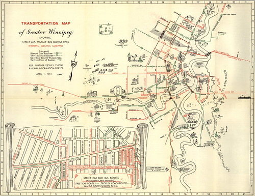
I grew up in Winnipeg, so I was thrilled to discover the thousand-plus maps of Winnipeg, Brandon and the rest of Manitoba posted on the Manitoba Historical Maps Flickr account. The maps include old city maps, transit maps, insurance maps, planning maps, topo maps, highway maps — some of which I actually recognized from my childhood. Favourites so far include a 1941 map of Greater Winnipeg’s streetcar, trolley bus and bus lines (above), a 1963 Texaco map of Winnipeg that seems awfully familiar (I probably had a more recent edition in the house when I was a kid), and 1954 Manitoba highway map. So: not just thrilled — giddy. Via Urban Cartography.

Comments
blog comments powered by Disqus