Ordnance Survey Announces Colour-Blind Mapping
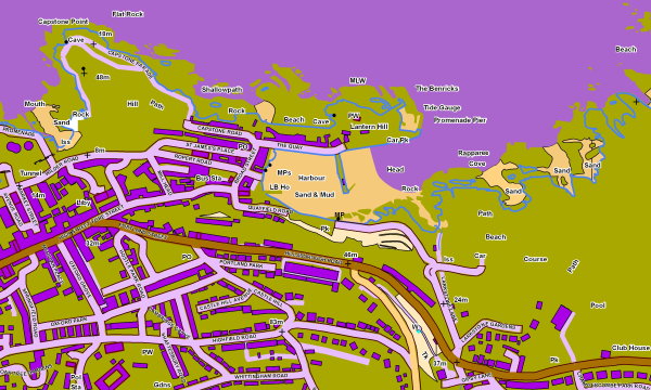
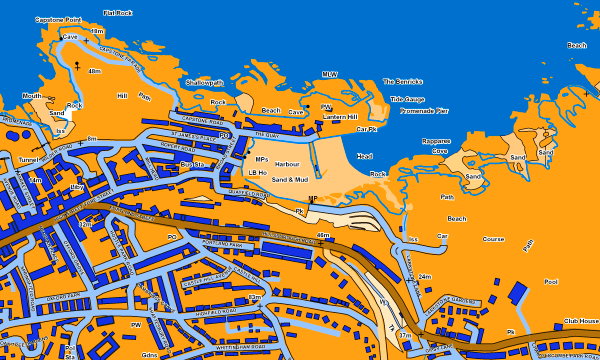
Hold your mouse over this map to see how it would appear to someone with colour-blindness.
The Ordnance Survey has announced a product that will, they say, make it easier to produce maps for people with colour-blindness. For the eight percent of the population unable to distinguish red from green, those colours “appear as shades of grey or brown, making it difficulty to interpret the colour‑coded features shown on maps,” says the OS news release. “The new Ordnance Survey digital mapping has been developed to be customisable, allowing for the creation of colour-blind-friendly styles, which to most people will look very strange but could help avoid future confusion for those with the condition.” The example shown above does look very strange indeed, but hover your mouse over the map and you’ll see how much better it looks if you’re colour-blind. (Can’t mouse over? Here’s the colour-blind image.)

Comments
blog comments powered by Disqus