Mapping Ice Sheet Thinning
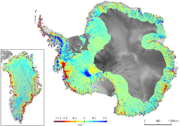
Maps compiled from data from NASA’s Ice, Cloud and Land Elevation Satellite (ICESat) reveal the extent of ice sheet thinning in Antarctica and Greenland.
ICESat’s precise laser altimetry instrument, launched in 2003, has provided a high-density web of elevation measurements repeated year after year across the Greenland and Antarctic ice sheets. … The maps confirm that the profound ice sheet thinning of recent years stems from fast-flowing glaciers that empty into the sea. This was particularly the case in West Antarctica, where the Pine Island Glacier was found to be thinning between 2003 and 2007 by as much as 6 meters per year. In Greenland, fast-flowing glaciers were shown to thin by an average of nearly 0.9 meters per year.
Via Slashdot. Image credit: British Antarctic Survey/NASA.

Comments
blog comments powered by Disqus