Early Views of Hong Kong
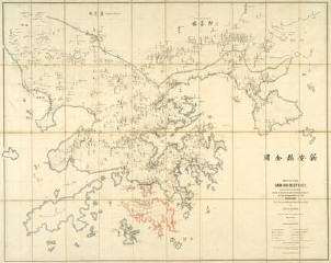 “Early Views of Hong Kong, 1842-1946” is an exhibition of maps of pictures and maps of Hong Kong from Wattis Fine Art in Hong Kong, including this 1866 bilingual (English-Chinese) map of Hong Kong (pictured at right), which sold for HK$360,000 just before the exhibit opened on May 8. The exhibition runs until June 8; the New York Times’s Globespotters blog has more. Via GeoCarta.

Comments
blog comments powered by Disqus