An Arctic Roundup
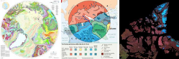
The Geological Survey of Canada has produced a geological map of the Arctic; the map is available in several formats online and will be published in print next year. Agence France-Press reports that the map is the result of data collected by several countries at a cost of a billion dollars, and shows not only potential natural resources (risible line in the article: “They do not reveal unknown deposits.”), but also may buttress competing territorial claims in the Arctic. Via GeoCarta.
Speaking of which, The Economist’s piece on various countries’ scramble to claim vast parts of the seabed, in the Arctic and elsewhere, has a good map of the potentially competing claims in the Arctic. Via Catholicgauze.
And finally, Natural Resources Canada discusses its new automated method for processing satellite images of Canada’s north: “The Landsat 7 Mosaic technology essentially creates an image map from hundreds of cloud-free, summer images taken by satellite between 1999 and 2002. The images are then merged to create single, seamless image bases of selected areas. For example, one image covers the entire area between the west Mackenzie Valley in the Northwest Territories to the eastern edge of Baffin Island in Nunavut, including the many islands in Canada’s northern Arctic.” Want technical details? Here they are. Via Vector One.

Comments
blog comments powered by Disqus