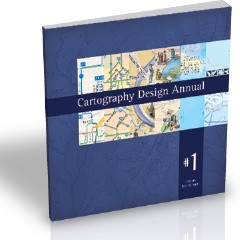
Review: Cartography Design Annual #1
Cartography Design Annual #1
Nick Springer, editor
Springer Cartographics, 2008. Softcover, 78 pp. ISBN-13 978-0-6152-2116-8
 Based on submissions from the Cartotalk community, this ambitious first iteration of the Cartographic Design Annual, edited by Nick Springer, is intended as a showcase of cartographic talent. A total of 36 maps, submitted by 29 contributors, are included in this volume.
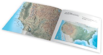
The reproductions are beautiful, a testament to just how good a self-published book produced via print-on-demand (this time at Lulu.com). But don’t expect an anthology of usable maps. The Annual only provides a sampling: one page shows the map in full, and usually considerably reduced; the facing page provides a readable excerpt. Don’t, in other words, plan on using this as an atlas.
The maps themselves are something of a mixed bag; some are better than the others. But comparing them to one another is very much an apple-and-oranges exercise: these are real maps designed for real purposes. Tom Patterson’s relief map of the U.S. is here, as is a map for National Geographic. But there are also park maps, city maps, tourist maps, and maps for specific purposes: energy in India, snowfall in Colorado, golf, wine. The selection is eclectic. Some are basic, some are functional, some are works of art; all, however, are maps made by working cartographers in the course of their jobs. (And I want to know where I can buy Hans van der Maarel’s globe chair.)
 Of the 36 maps in this collection, 20 are maps of the U.S. or constituent part (a park, a city), and nearly three-quarters of the maps depict some part of North America. Compare this with three world maps and two maps from Europe. Hopefully, the focus in future volumes won’t be quite so lopsided.
Each map is accompanied by a list of the software used to make it and the data source; it’s revealing that more than two-thirds of the maps were made with Adobe Illustrator, more than half with Photoshop, more than a quarter with Avenza MAPublisher and ESRI ArcGIS, and more than a fifth with Manifold. (Most maps were made with several applications.) It’s a useful barometer of the state of the art; I would, however, like to see more information provided, such as the projection used (at least for larger-scale maps) and, perhaps, a short note from the cartographer explaining what went into the map.
All in all, Nick has put together a revealing snapshot of what the field is producing; I can only look forward to subsequent volumes, for which I hope he ends up having to turn down too many good maps. The more cartographers hear about this project, the more submissions Nick gets, the better this series will be. A bit pricey at $40 for a 78-page paperback, but that’s the economics of POD for you, especially in full colour.
I received a review copy of this book.
Previously: Cartography Design Annual.

Comments
blog comments powered by Disqus