Another Internet Country Code Map
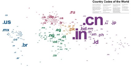
Here’s another map showing country code top-level Internet domains, available as a 24×36-inch poster. “Each ccTLD is sized relative to the population of the country or territory, with the exception of China and India, which were restrained by 30% to fit the layout. At the other end of the spectrum, the smallest type size used reflects those countries with fewer than 10 million residents.” Via Boing Boing.
Previously: Internet Country Code Map.

Comments
blog comments powered by Disqus