Review: Canada Back Road Atlas
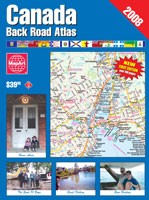
Canada Back Road Atlas
MapArt, 2007. Paperback, 702 pp. ISBN-13 978-1-55368-614-9
 MapArt is easily the largest publisher of road maps in Canada, publishing not only maps of cities and metropolitan areas (both as folded maps and as coil-bound and saddle-stitched atlases), but also large-scale maps of rural areas, providing information on back roads and recreational areas at a level of detail that official highway maps, single-sheet maps and, I suspect, navigational systems simply cannot match. I’ve almost always had a few with me when I travel — where else am I going to find maps of Ontario cities like Guelph or Pembroke?
Now they’ve gone and done something outlandish, quite possibly simply because they could: they’ve published a giant, 700-page omnibus of their provincial back road atlases.
The Canada Back Road Atlas contains large-scale maps for all provinces, and small-scale maps for some. Map scales vary from region to region, due no doubt to the originating back roads atlases and to the relative sizes and densities of each province. Large-scale maps range from 1:250,000 for southern Ontario, Quebec, and the Maritimes, to 1:500,000 for Alberta, British Columbia and Newfoundland (Labrador and the territories get smaller-scale maps only) and 1:540,000 for Manitoba and Saskatchewan. The smaller scales do not feel particularly cramped, though the range lines can get in the way on the prairies; insets of city centres and high-density areas are provided for provinces that don’t get the 1:250,000 treatment. The 1:250,000 maps provide fantastic detail, but they also necessitate frequent page-turning. Small-scale maps provide coverage for sparsely populated areas as well, though not for southern Ontario or the Maritimes.
The atlas is broken into several discrete sections — Alberta and B.C., Saskatchewan and Manitoba, Ontario, Quebec, and the Atlantic provinces. It’s a little confusing at provincial borders between sections: my section of Quebec, for example, is covered by an Ontario map plate, which is not replicated in the Quebec section. Large-scale plates pan from north to south, west to east, except in Ontario, where it’s south to north, and they pan across provinces within sections, which is also hard to follow.
All the same, it’s an impressive effort, and one that I’ve been flipping through compulsively. I like it a lot. And it’s a bargain at $40. It is a little too unwieldy to keep in your car, though: it’s heavy, printed on a heavier, glossier paper than other atlases, and it eschews coil binding for perfect binding, which makes me worry that I’m going to crack the spine reading it. I think this will be best as a desk reference; road trips will still need smaller maps and atlases.
I received a review copy of this book.
- Buy Canada Back Road Atlas at Amazon.com

Comments
blog comments powered by Disqus