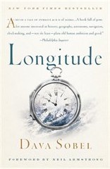
Review: Longitude
Longitude
by Dava Sobel
Walker and Company, 1995, 2007. Paperback, xiv + 184 pp. ISBN-13 978-0-8027-1529-6
 Latitude and longitude are basics of accurate map-making and navigation. In an age of pervasive GPS signals, it’s easy to forget that determining your location was not at all straightforward until relatively recently. Calculating latitude has always been simpler than calculating longitude. Latitude can be determined observationally: by measuring the angle of Polaris above the horizon, or the altitude of the sun, moon or other celestial objects on known dates.
In the 18th century, an accurate method of determining longitude was a matter of some urgency. In Britain, a Board of Longitude was convened and a £20,000 prize announced for such a method. There were many crackpot ideas, but it was believed that astronomical observation could also be used to determine longitude, but at the time, the state of astronomical knowledge was not yet at a point where this could be done. Astronomers simply did not yet have accurate measurements of the stars.
When all you have is a hammer, everything looks like a nail. While astronomers populated the Board of Longitude and looked for an astronomical solution, English clockmaker John Harrison worked on an alternative solution: a clock. The Earth rotates through 360 degrees in 24 hours — 15 degrees an hour, or a degree every four minutes. Longitude could be calculated from the difference between local noon (which could be observed) and noon at a known point: if noon came an hour earlier than it did at that known point, you were 15 degrees west of it.
But, as the state of astronomical knowledge was insufficient to the task, so too was the state of clock technology. While astronomers conducted their observations and compiled their tables, Harrison spent decades working on a series of timepieces that could handle the vicissitudes of sea travel and could continue to tick even while being wound. Two competing methods came to fruition at roughly the same time: Harrison’s timepiece, which was accurate, easy to use, but expensive; and astronomer royal Nevil Maskelyne’s lunar tables, which were complicated to use but inexpensive to reproduce. Intrigue ensued. Eventually, other clockmakers were able to reduce the cost of manufacturing chronometers — as they became known — to the point where they were in regular use in British ships by the early 19th century.
This, in a nutshell, is the story told in Dava Sobel’s Longitude, a fascinating look not only at a man and his timepieces, but also at an age where necessity truly was the mother of invention. Longitude was first published in 1995, became a bestseller, and spawned a TV movie in 2000 (which I haven’t seen). It’s a phenomenon, and rightly so. This little book is absolutely engaging; those with an interest in the history of navigation, cartography, astronomy and, yes, clockmaking will find something to enjoy. My readers told me a year ago to read this book, and boy were they right. Highly recommended.
(See also the History of longitude Wikipedia entry.)

Comments
blog comments powered by Disqus