MacArthur Maze vs. U.S. Route 90
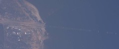 Some more material about updating road data after disasters that I missed the first time around (and am only getting to now). Via Mapping Hacks, a San Francisco Chronicle article that discussed updating driving directions in the wake of the MacArthur Maze, but that also looked at the big picture: updates take an awful long time. Another case in point, and an understandably touchy one: the U.S. Route 90 bridge in Mississippi was destroyed by Katrina a year and a half ago, but it’s still in the mapping databases, and directions are still given over that now-nonexistent bridge.
What does this say when compared to the MacArthur Maze update, which occurred within days of the collapse? Such updates — like error corrections of obvious driving direction snafus — seem manual in nature. Someone has to catch them, and report them. So it might be easy to infer that, as far as the tech community is concerned, a major commuter route in the Bay area — their backyard — is going to get more attention, and be deemed much more urgent, than a highway bridge in Mississippi. On the other hand, there’s no comparing the very real difference in impact. But I imagine that the alacrity with which the MacArthur Maze was updated might be seen as a slight where similar situations did not result in speedy updates.
Previously: How Online Maps Update Their Data After Major Road Closures.

Comments
blog comments powered by Disqus