Afriterra
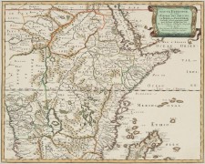 Afriterra is an online collection of digitized maps — 500 have been done so far out of a planned thousand in the current funding round, with a total of 5,000 maps in the collection, dating from the 15th century to 1900. Maps are available via the usual Zoomify Flash interface; the database is more searchable than browsable, but with a little patience some interesting stuff can be found. Via MapHist.

Comments
blog comments powered by Disqus