The Map of Early Modern London
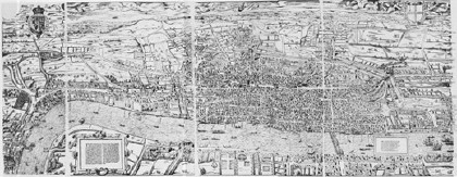
The Map of Early Modern London is an interactive annotated map of London based on the 16th-century “Agas” woodcut map, with clickable points (akin to Google Maps pushpins) that take you to more detailed information about a given location. Via Things Magazine.
See previous entries: Old London Maps; 17th-Century London in Google Earth.

Comments
blog comments powered by Disqus