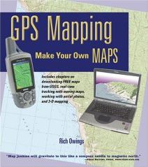
Book Review: GPS Mapping by Rich Owings
GPS Mapping: Make Your Own Maps
by Rich Owings
Ten Mile Press, 2005. Softcover, 382 pp. ISBN 0-9760926-3-8
 This is a book for people who want to get their hands dirty with mapping software and GPS units and generate maps from the combination of the two. Almost all the software covered is Windows-based, and the mapmaking part requires a GPS, so, as a Mac user who for some reason still doesn’t own a GPS unit, I was somewhat at a disadvantage while reading this book — I couldn’t try any of it out! But I can at least give you a sense of what you’re getting yourself into when you get this book.
Rich Owings is an outdoor enthusiast and the author of GPS Tracklog, a blog about GPS that focuses on reviews and outdoor use (see previous entry). For Owings, making your own maps means taking the tracks and waypoints generated by your GPS unit from your travels and plotting it on maps using software — and that’s the focus of GPS Mapping. This can be a lot of fun, and even useful — as he points out, sometimes you can even plot a hiking trail with greater accuracy than the topo map!
After introductions to the use of GPS and digital map data sources, both online and on CD-ROM (this material is very helpful, and very interesting, but too brief, and could be expanded), Owings delves into the meat of his books: step-by-step descriptions of how to use a GPS receiver with nearly two dozen software packages, with the pros and cons of each. It’s awfully comprehensive, and awfully impressive, and no doubt useful.
(Personally, I prefer a big-picture approach to software documentation — fewer step-by-step instructions, more general examples. I thought there were too many screenshots of menu items, but not enough of the software’s imagery. But I also know many people for whom the step-by-step approach and close focus is essential, so I’m probably in the minority.)
But Owings’s approach — essentially, providing a user’s manual for the software in question — is not without its limitations. First, as new versions of the software are released and old software goes obsolescent, the book will get dated very quickly. Technical manuals, which in rapidly changing fields can be outdated before they’re even published, depreciate like a new car. Fortunately, Owings is posting updates on the book’s web site — a reasonable fix. The second limitation is that there’s no way that the average user is going to use each program Owings describes: some are specific to one GPS brand, for example. For many readers, much of the book will go unused.
But, having said that, these limitations are the fault of technical manuals as a genre, rather than a shortcoming of this particular book. If you’re the outdoorsy sort, and you’d like a detailed guide to the full mapping potential of your GPS unit or a detailed survey of the available software, then this is your book. But GPS Mapping’s technical focus makes this a hands-on manual, not a casual read — i.e., have a GPS unit!
I received a review copy of this book. More on my book review policy.

Comments
blog comments powered by Disqus